The creation of High Chelmer
Location of board
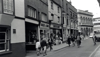
Tindal Street, outside wall of Boots
The Yards
By the early 20th century, there was a growing demand for retail establishments and traffic improvement in Chelmsford town centre, which led to the closure of many inns in the town.
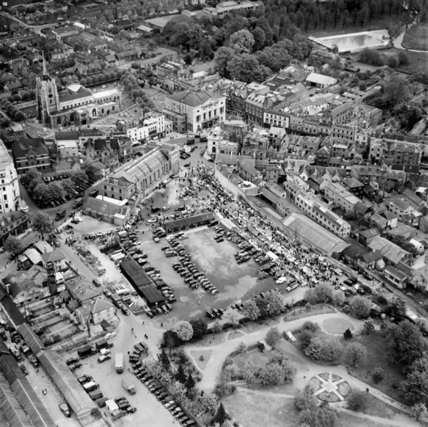
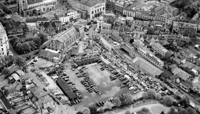
The rear of the inns, between Tindal Street and the existing Market, became a mass of decrepit yards, only reached by alleyways and passages under archways. For decades, the Borough Council struggled to improve the condition of these yards. It tried, without success, to use the Housing of the Working Classes Act 1890 to help improve the condition of the buildings, but after years of neglect, the state of the yards would eventually result in their demise.
By the late 1960s, as development and expansion occurred periodically throughout the century, the first shopping precinct for the town was proposed.
1945 Planning Survey
Chelmsford Area Planning Group, formed in 1935 by interested local residents, commissioned architect and town planner Anthony Minoprio to undertake a survey of the borough and make suggestions for improvements. This Planning Survey was a privately-funded venture, mainly by the Hoffmann, Marconi and Crompton Parkinson companies, and was an essential part of post-war reconstruction following the Second World War.
Minoprio's findings suggested that the four-and-a-half-acre market place, which was sited south of Market Road and north of the Recreation Ground was a “wasteful use of land”. He was also particularly critical of the Tindal Street “island” between the High Street and Tindal Street, describing it as “too narrow for well-planned modern shops” and an obstacle to the economic “progress and development of the town”. As a result, Miniprio felt that the whole Tindal Street area should be re-planned to provide the town with a new convenient shopping centre.
In 1945, Minoprio's plan for the town included the complete relocation of the existing cattle market, west of Tindal Street, to a site in Victoria Road adjacent to the river. He suggested the remaining site should subsequently be replaced with a car park and an extension to the town's central shopping area. There was no direct opposition of this view by the local press or the local authorities. Instead, in 1952, these broad proposals were largely adopted as part of the Development Plan published by the County Council, following the introduction of the Town and Country Planning Act 1947.
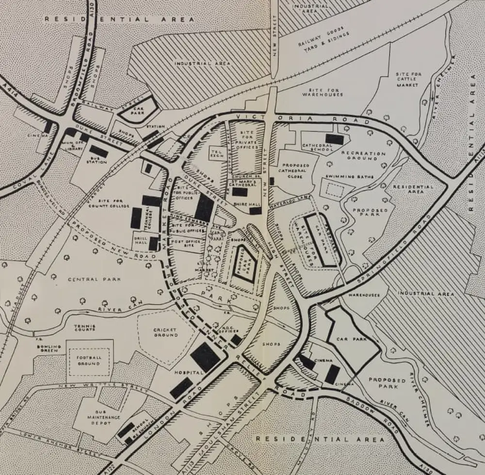
Development Plan, Report of the Survey by Minoprio, 1952, reproduced courtesy of Essex Record Office
CDA 15
Between 1957 and 1961, three preliminary proposals for the redevelopment of the town centre were drawn up by both the County Planning Department and the Borough Engineer. All three proposals were largely similar in terms of their plans to segregate pedestrian and vehicle traffic, however, they differed in how this could be achieved.
One scheme proposed to pedestrianise the roads within the city centre, and another recommended the construction of a two-tier pedestrian deck system, where people would use a higher deck for walking above the existing road underneath.
Interestingly, the proposed deck system gained more support from the Borough's Buildings and Town Planning Committee than the on-the-ground pedestrianisation plan.
In 1961, faced with alternative proposals from their own Engineer and the County Council, the Borough decided to seek the advice of the Civic Trust, a public body formed in 1957 to improve the general quality of urban life, including its new and historic buildings and public spaces. Noel Tweddell, the Trust's deputy director, agreed to provide advice to the Council on the basis that the Trust's funds were covered, equivalent to what an independent consultant would have been paid.
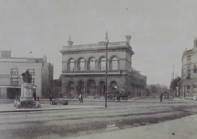
In his 1962 report about the proposals, Tweddell concluded that the pedestrian deck scheme would be too costly to construct and would require the need for re-building and adaptation of properties. Instead, he produced a layout plan of the proposed Comprehensive Development Area west of Tindal Street (known as CDA 15), which included a shopping precinct, multi-storey car park, offices, social hall, and an open-air retail market, to replace the Corn Exchange, whilst preserving its façade. The new one-level scheme would yield 170,000 square feet of shopping space with 133 shops.
Oppositions to these proposals were limited and Compulsory Purchase Orders were drawn up in the summer of 1964 for the purchase of various shops, pubs and cafes.
It soon transpired that 33 of the 70 properties that were subject to the compulsory purchase were owned by Ravenseft Properties Ltd, as well as 90% of the land contained by Tindal Street, New London Road and the River Can. Following the public inquiry in 1965, the Council therefore accepted the offer from Ravenseft Properties Ltd to undertake the commercial part of the scheme, while the Council would be responsible for the new roads, car park and social hall.
By 1968, the scheme was well advanced, and a second inquiry had been undertaken. While there had not been much concern from the public about the loss of the buildings on the west side of Tindal Street at the time, there were several objections about the loss of public amenity space in Bell Meadow, on the north side of the river. Because of this, the inspector ruled that the depth of the riverside garden should be increased, and the residences proposed in this area eliminated. Quietly, the preservation of the front of the Corn Exchange had also been dropped.
Demolition for Phase 1 consequently began in May 1969 and was completed by August. Between June and November of that same year, the town soon began to rouse to the idea of the scheme, when the Council released an updated model of the CDA 15 proposals.
Many features of the original scheme were gone, including open market stalls and individual shops fronting New London Road. Objections were also raised about the dominance of the proposed car park as well as the placing of the market underneath it. As a way of compromise, the only concession made to these objections was the concealment of the service yards within the precinct, so they could not be seen from Tindal Square or the riverside gardens of Bell Meadow.
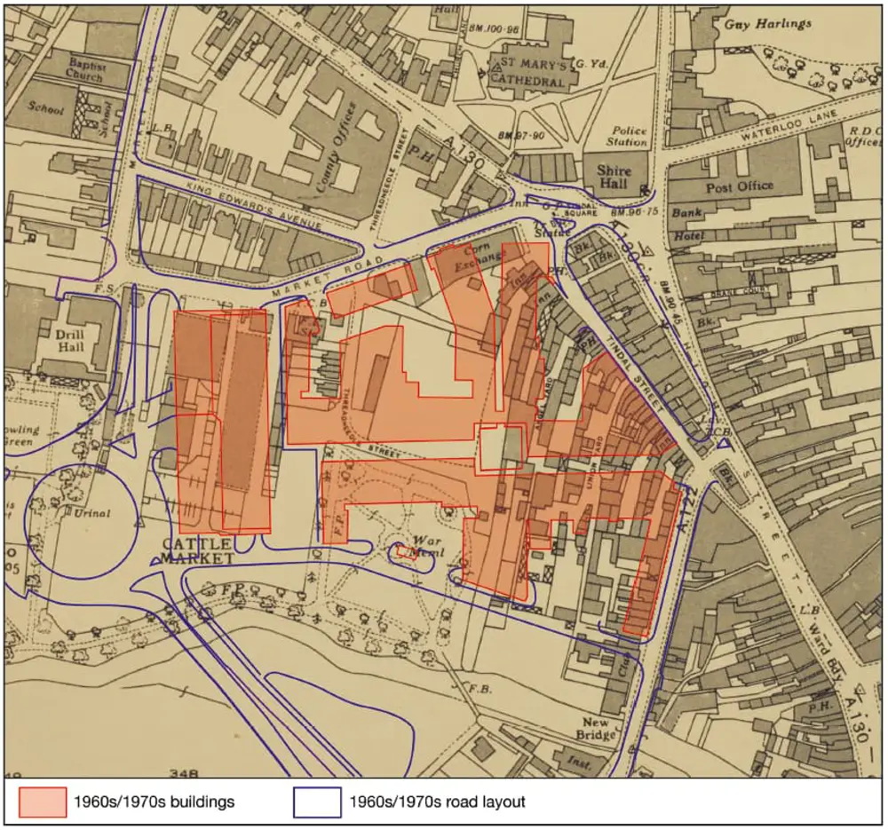
High Chelmer layout overlaying existing street pattern, 1974, reproduced courtesy of Essex Journal and C. D'Alton
Public protest
High Chelmer (an amalgamation of High Street and River Chelmer) was opened in 1971. Almost half a century later, this busy shopping precinct continues to thrive. However, had the project been delayed, it is very likely that it would not have been completed.
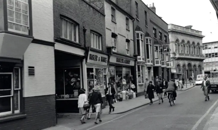
In 1967, The Civic Amenities Act introduced Conservation Areas. Tindal Street would have undoubtedly been preserved as part of this, and many of its ancient buildings listed on the west side, just as their counterparts on the east side were in 1978.
John Marriage, author and member of the Marriage family, was concerned about how little had been done to conserve the best of the past. In 1982, he described the destruction of “one of the town's most interesting streets” as “an act of pure vandalism, needlessly perpetrated and is now still mourned by older Chelmsfordians.”
Despite there being little objection to the loss of the Corn Exchange and Tindal Street before development began, these two very important features to Chelmsford's history continue to be lamented by Chelmsford residents to this day.
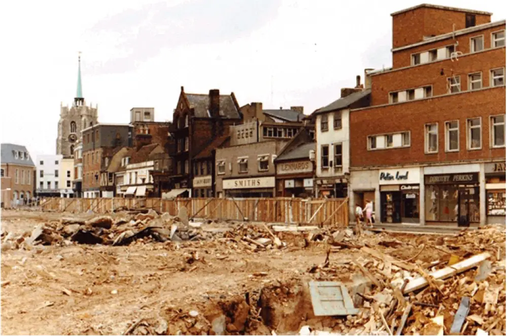
Tindal Street demolition, c. 1970
Conclusion
Although the historic character of individual places is significant to a city's cultural heritage, in Chelmsford, High Chelmer has now become a part of this historic context, as the city continues to grow.
Information about High Chelmer development reproduced by courtesy of Dr James Bettley. For more information, see J. Bettley, 'Chelmsford Planning Survey and the High Chelmer development, 1945-73', Essex Journal, 51, II (2016), pp. 72-84.

